On April 28, Zanna Stutz of Glen Canyon Institute gave a very enlightening presentation about the complex hydrology and interstate politics now surrounding Lake Powell and the Colorado River system and the resulting rebirth of long submerged ecosystems in Glen Canyon. Also Jenny Holmes of SUWA provided an update on pending Congressional action threatening the scientifically based, well vetted management plan for Grand Staircase-Escalante National Monument in southern Utah.
The webinar recording is now available on the OFWU web site (click here, 62 minutes).
What is Happening in Glen Canyon?A Story of Shifting Hydrology, Failing Infrastructure, and Ecological Restoration
Join us to hear from Zanna Stutz about the complex hydrology and interstate politics now surrounding Lake Powell and the resulting rebirth of long submerged ecosystems in Glen Canyon. Originally from the Pacific Northwest, Zanna now works with the Utah-based organization, Glen Canyon Institute (GCI).
UPDATE: Also Jenny Holmes of SUWA will provide a short report with the latest news from Capitol Hill on pending legislation threatening the scientifically based, well vetted management plan for Grand Staircase-Escalante National Monument in southern Utah.
In 1963, the massive Glen Canyon Dam blocked the Colorado River to create the reservoir known as Lake Powell. This action drowned the heart of the Colorado Plateau, ancestral Indigenous homelands, and what many consider to be America’s Lost National Park. Over the last 25 years, climate change and over-consumption have caused the reservoir’s levels to plummet. The dam was not designed to function at these low levels, and this condition now presents a serious risk to water delivery for downstream users and ecosystems, including those within the Grand Canyon. And yet, as Lake Powell recedes, cultural resources, unique geologic formations, and native wildlife communities have reemerged in Glen Canyon.
In the midst of the Colorado River’s ongoing water management crisis, Glen Canyon stands as a beacon of hope, presenting the opportunity to protect and restore one of the planet’s most stunning landscapes.
Growing up in Portland, Zanna Stutz always loved spending time outside with family and friends. This passion led her to work as a whitewater rafting guide in Colorado and Oregon and later as a ski patroller and river restoration technician in Utah. Zanna graduated from Dartmouth College where she studied geography, public policy, and Spanish. She also conducted research focused on how the understanding of climate change influences the environmental politics and conflicts surrounding controversial dams. Now serving as program director at GCI, Zanna leads projects related to outreach, education, and field work.
Glen Canyon Institute is a science-based nonprofit dedicated to the restoration of Glen Canyon and a free-flowing Colorado River through the Grand Canyon. GCI is committed to:
advocating for science-based public policy to protect environmental and cultural resources,
facilitating research to inform management policies and better understand dynamic canyon processes, and
educating the public and decision makers about the need to restore Glen Canyon.
Please register below and join us to learn about the evolving state of Glen Canyon and what you can do to help.
Public Lands Under Threat: The Hope and Challenge of Bipartisan Defense of America’s National Treasures
Our public lands are threatened by industrialization and privatization more than ever. The successful bipartisan pushback to remove a provision introduced by Utah Senator Mike Lee to sell off public lands in 11 Western states in the 2025 Big “Bad” Budget Bill gives hope that, once again, Americans can unite across party lines to protect their public lands. What were the factors behind this successful effort to stop the sell-off? As threats continue, what can we learn? With public lands enjoying broad public support, what other legislative tactics might Sen. Lee and allies use in the future to escape public scrutiny of their proposal?
Join with Oregonians for Wild Utah, Washington Friends of Wild Utah, and the Southern Utah Wilderness Alliance to hear from a Portland-based expert, Jackie Feinberg of the Sierra Club, who has a broad national perspective on the successful opposition to this provision and how we can build on this accomplishment going forward. Also we’ll discuss some emerging threats and how the concurrent gutting of our public land agencies affects this fight.
This webinar will take place on Tuesday, September 9 at 7:00 p.m. PDT. Kelsey Kagan of OFWU will moderate. Advance Zoom registration is required.
Please join us then to learn what you can do to help protect our public lands.
Jackie Feinberg is the National Lands Conservation Campaign Manager for the Sierra Club, focusing on public land protections and defense, strengthening land management, and balancing renewable energy siting with conservation. Outside of work she can often be found hiking or bouldering. While based in the Pacific Northwest, her favorite monuments and public lands to visit are places like Grand Staircase-Escalante National Monument in the Utah desert.
Recognized photographer Stu Levy has photographed the iconic scenery of southern Utah on multiple occasions. Notably, he studied with Ansel Adams and served as an assistant instructor for Adams’ workshops in Yosemite and Carmel. Closer to home, Stu co-founded the Portland Photographic Workshops and has led photography workshops on the Oregon Coast for over 30 years.
Stu generously shared a set of favorite images that he has taken over the years in southern Utah.
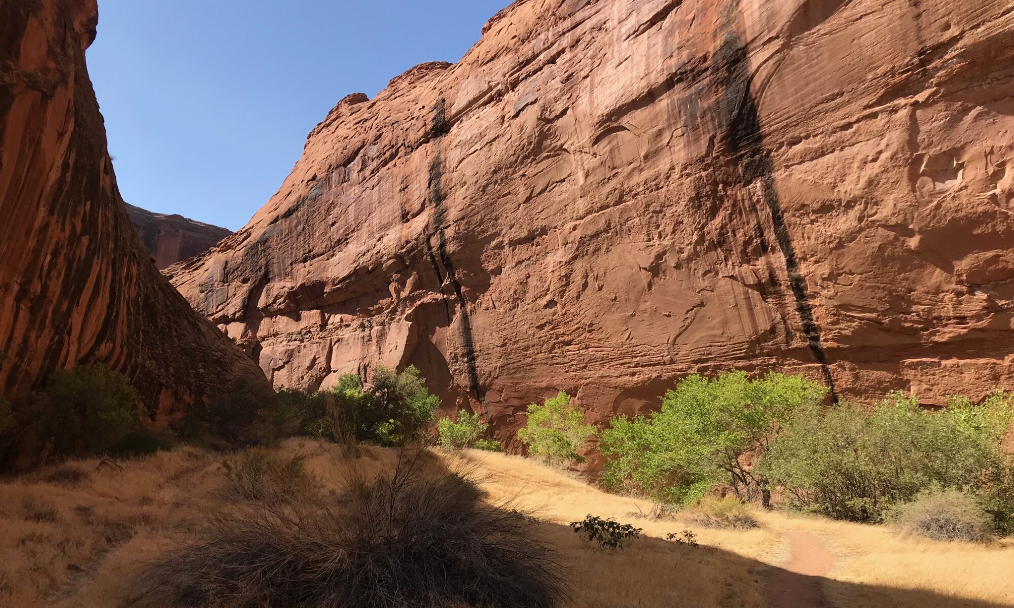
Fifty Mile Mountain, EscalanteBranches and Wall, Choprock, EscalanteBurr Trail (West of Capitol Reef)Coyote Gulch, EscalanteHell’s Backbone, EscalanteLower Calf Creek Falls, EscalanteStorm, Henry Mountain Flame Ruin, Bears EarsThe Toadstools, Grand Staircase-Escalante National MonumentNeon Canyon Cathedral, EscalanteHoodoo (Navajo land, south of Bluff)
Update: A video recording of Phil’s gallery talk on February 8 is now available on YouTube. Images of the works shown are available here. The exhibition will continue through February 28.
Long-time Utah wilderness supporter and OFWU member Phil Bard will present an exhibition of his photographs of the Desert Southwest next month at the Augen Gallery in downtown Portland (716 NW Davis St, 97209).
OFWU members and friends are invited to attend a reception on Saturday afternoon, February 8, from 1:30 p.m. to 4:00 p.m. Phil will speak about his work at 2:00 p.m.
In addition, Phil graciously will donate a portion of the proceeds from this event to benefit the Southern Utah Wilderness Alliance (SUWA).
In early September, I had the good fortune to represent Oregonians For Wild Utah at this year’s SUWA Grassroots Leaders Retreat in southeastern Utah. There I had the chance to interact with over forty other activists from around the country, subject matter experts, and SUWA regional organizers. We were based for four days and three nights outside the town of Boulder, midway between the high alpine forests of Boulder Mountain and the depths of Grand Staircase-Escalante National Monument (GSENM). This trip represented my first return to this uniquely beautiful area in over two decades.
What made the overall experience particularly encouraging for me was the active participation and raw enthusiasm of so many younger activists, including a number drawn from the Latino/a community in Utah. The densely packed program interspersed lectures with time spent in the field, including hikes along the Burr Trail east of Boulder and in the Escalante River Canyons. At a recently restored site previously damaged by vehicle use and carelessly built campfires, we learned about the multiple positive impacts of the volunteer-driven stewardship program from SUWA’s Jeremy Lynch and a BLM wilderness ranger who works closely with these visiting groups.
Back at camp, we learned interactively about the diverse species of bats inhabiting the GSENM from Dr. Jackie Grant, who now leads the Grand Staircase-Escalante Partners and previously was a biology professor at Southern Utah University. Dr. Emmanuel Santa-Martinez of Salt Lake Community College taught us about the breadth and importance of pollinators in the ecosystem. Finally, we heard a truly inspiring presentation by SUWA board member Tara Benally, a member of the Hopi Tribe and a long-time resident of the Navajo Reservation. Tara provided a moving description of her life growing up on Tribal lands, a historical perspective of the many injustices committed against the Tribes over the last two centuries, and her efforts organizing Tribal members on the Colorado Plateau around electoral participation and wilderness.
I came away from this retreat re-energized to work in Oregon to help protect the wild lands of southern Utah and the rest of the Colorado Plateau. In particular, I hope to return to this area next summer on a stewardship trip and to get more first-hand experience with this beautiful and in Tara’s words, “time immemorial” landscape. I am grateful to SUWA and in particular, to our West Coast organizer Jenny Holmes for this opportunity
Steve Corbató, Oregonians For Wild Utah – December 1, 2024
Two years after moving west from the East Coast in 1975, I took my first trip to the Colorado Plateau. It was a life altering visit, I came home energized by the complexity of the landscape and the seemingly endless possibilities it held for exploring the plateau’s phenomenal geology. Although I was only an amateur photographer, I dragged a camera everywhere. Now, after retiring from a career as a commercial shooter, I’m still hauling my gear along every time my partner Alice and I head to the redrock, still making new discoveries in this unique part of the world.
Hiking Coyote Gulch in Escalante in 1981 using “state of the art” backpacking gear
For the last several years we’ve taken off for a month in spring and also in the fall, staying in the Four Corners area and spending as much time as possible in both familiar and never before visited wild places. Though there are many unprotected and partially protected areas in this region, some of the ones that are safely locked away from commercial exploitation, that is, the National Parks, still call us back despite the fact they are often crowded. They are magnetic to a camera lens but its a bit harder to find a new image there compared to in less traveled places. I try nonetheless. We manage to find trails with fewer visitors, the Needles District in Canyonlands being one of our favs. There are few amenities there and many of the trails are long, strenuous and not particularly suitable for the light hiker.
On the Peekaboo Trail, Canyonlands
Sandstone towers and hoodoos above Big Spring Canyon, Canyonlands
Our go-to is the hike to Chesler Park. Once out there its usual to see only a handful of others, and the huge ring of Cedar Mesa Sandstone pillars is majestic as it dominates the grassy meadow that lies within.
Towers and Cirrus formation, Chesler Park, Canyonlands
This year we managed to spend a couple days in the Bisti/De-Na-Zin Wilderness, somewhere I’ve wanted to go for years. The 45,000 acre area is co-managed by the BLM and the Navaho Nation (most is public land, except for a few Navaho-owned parcels). The most visited and accessible portion is at the western boundary, 40 miles south of Farmington, New Mexico and down a three-mile gravel road from main highway. A one-mile hike up the broad wash takes you into a land of carved valleys populated by thousands of hoodoos, which parade merrily about everywhere you look. Its one of the most photogenic places I’ve ever been to, and there are usually very few other visitors so you feel like you have it all to yourself.
Bisti Badlands
Bisti Hoodoos
Highlights include petrified logs, shale and sandstone towers and a group of weird, rounded hoodoos called the Alien Egg Hatchery. My preferred areas, however, are amongst the surreal mud flows and scattered boulders that present endless possibilities for photographic abstracts.
Hardened mud and boulder field
We are back home in Portland now, but sad to be away from the plateau. Our photos will have to get us through the winter until the next time we point the car towards the southwest.
By Gloria Gardiner, OFWU Steering Committee (all photos by the author)
For many years, I have hiked and photographed public lands in Utah and participated in land stewardship projects in the Pacific Northwest. On Saturday and Sunday, May 4-5 of this year, I participated in a SUWA stewardship weekend in southeastern Utah.
Of the nine volunteers, most were from Utah. One was from the Denver area, and I came from Portland. Our project leader was from SUWA, and a BLM backcountry ranger selected the projects and worked with us all weekend. The overall objectives were (a) to delineate the boundaries of BLM’s Coal Canyon Wilderness Study Area (WSA), and (b) to discourage illegal motor vehicle use inside the WSA. The work sites were about an hour east of Moab, Utah, and north of Interstate 70 in the Book Cliffs, the longest continuous rock escarpment in the world.
We began work on Saturday at a particular wash that comes out of a canyon in the WSA. It channels floodwaters, but it also attracts illegal off-highway vehicles (OHV) to travel into the WSA. On Saturday, with the BLM ranger’s direction, assistance, tools, and materials, we built a flood fence across the wash. This simple fence used wood posts, a steel cable connecting the posts, and wooden 2×4’s hanging from the cable but not touching the ground. The fence blocks most vehicular access while allowing flood waters to go down the wash. We finished this project in one day.
The ranger went back to Moab, and the rest of us set up a primitive camp for the night. I lay in my tent on my ancient Therma-Rest inflatable pad, covered by my down sleeping bag, and looked up at the cottonwood trees and desert sky. It was completely quiet. Our SUWA project leader provided dinner on Saturday night and coffee the next morning.
It took only part of Sunday to complete the other projects. First, we put wooden legs on a metal BLM sign and erected it at the WSA boundary.
Next, we disguised evidence of illegal motor vehicle usage in several places. We used boulders, dead juniper limbs, and duff from under living juniper trees. We shoveled and raked dirt to remove tire tracks.
Then we went our separate ways.
I stayed three more days in Moab to hike the East Rim and West Rim loop in Dead Horse Point State Park and the Murphy Trail in Canyonlands National Park’s Island in the Sky unit. I also drove the scenic La Sal Mountain Loop Road. Driving south of Moab in a counter-clockwise direction, the road descends from the snow-capped La Sal Mountains into Castle Valley, with red rock formations that rival those in Arches National Park. A left turn onto Utah Route 128 follows the Colorado River canyon west back to Moab. Here are a few of my photographs.
Dead Horse Point State Park
Island in the Sky District, Canyonlands National Park
Thanks to all who joined us on May 22 for an informative webinar discussing Bears Ears National Monument with Judi Brawer and Dr. Lauren Henson. Their combined slide deck is posted here.
If you missed the webinar or just would like to view it again, our friends at SUWA have made the video recording available here.
As a reminder, the Bureau of Land Management is accepting public comment on its draft Resource Management Plan for Bears Ears through June 11. Public comments can be submitted via this web site (choose Participate Now on the left taskbar).
Wildlands attorney Judi Brawer of the Southern Utah Wilderness Alliance (SUWA) and Tribal ecologist Lauren Henson will join us to provide an in-depth overview of the planning process and the opportunity – now open through June 11 – for the public to provide public comment on this draft plan to the BLM.
Under the Presidential proclamation restoring Bears Ears, five regional Tribes – the Hopi Tribe, the Navajo Nation, the Ute Mountain Ute Tribe, the Ute Indian Tribe of the Uintah and Ouray Reservation, and the Pueblo of Zuni – play a special role in the management of the monument. During this webinar, we will learn more about the perspectives of the Bears Ears Commission from Dr. Lauren Henson.
Lauren leads the Bears Ears Cultural Resources Subcommittee for Land Management and facilitates communication among Tribal departments, Traditional Practitioners, Cultural Advisors, and Leadership within and between Tribes involved in the co-management of Bears Ears National Monument. Lauren also works to provide opportunities for communities to re-connect with the land and organizes conservation programs for Elders and Youth at Bears Ears. As a wildlife biologist with experience weaving western science and Indigenous knowledge to inform land stewardship, Lauren is committed to collaborative management that recognizes, respects, and advances Traditional knowledge.
Please join us Wednesday, May 22 for an interesting and timely discussion. Advance registration is requested.
My first experience with Southern Utah began in 1984 as I bicycled over Soldier Summit in a July snowstorm, en route from Seattle to Santa Fe. A day later, I pedaled up to the Arches Campground in 100 degree heat, where I spent the day reading Edward Abbey’s Monkey Wrench Gang in the shade of a Juniper tree. I fell in love with the vastness of the skies, the color of the rocks and even the stifling heat.
Five years later, when the school where I worked in Seattle expanded its outdoor education program, I helped develop and run a program that took middle school children to Bryce Canyon, Zion, and Canyonlands National Parks, and to other public lands and State Parks. We studied geology, climate and weather, ancient cultures, current issues, water use, leave no trace wilderness travel, leadership skills and geology among other subjects, in the richest classroom in the world.
Twenty-three times between 1989 and my retirement in 2017, I was able to experience the wonder of Weeping Rock through new eyes with yet another group of students, and each year, they amazed me with their insight, their artwork, the essays and poetry they wrote, their ability to adjust to life where we had to be mindful of the other beings who relied on the spring from which we drew our water.
Some 250 students took part in our Southwest program and many, citing their experiences in Utah, have gone into outdoor leadership, wilderness medicine, environmental sciences and other educational fields. I am thankful that I had the opportunity to use my position as an educator to help students find ways to make the world a better place.
I am the teacher of athletes,
He that by me spreads a wider breast than my own, proves the width of my own,
He most honors my style who learns under it to destroy the teacher.